'From Source-to-Sea' - Dave Hillman
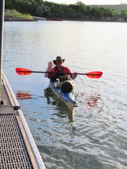
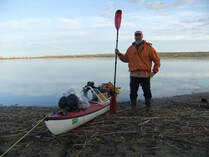
Fresh off this summers 3500 mile, 124 day journey down the Missouri and Mississippi rivers to the Gulf of Mexico. Iowa native and SDCKA member. Dave Hillman presented his 2022 Source-to-Sea expedition, he planned his progress to meet up with the Missouri River Paddlers Rendezvous that started at Ft. Randall on July 30, 2022; it was a great addition to an already epic adventure....Thanks Dave!
Fresh off this summers 3500 mile, 124 day journey down the Missouri and Mississippi rivers to the Gulf of Mexico. Iowa native and SDCKA member. Dave Hillman presented his 2022 Source-to-Sea expedition, he planned his progress to meet up with the Missouri River Paddlers Rendezvous that started at Ft. Randall on July 30, 2022; it was a great addition to an already epic adventure....Thanks Dave!
Fort to Field 50
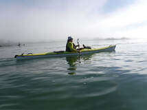
Paddle 50 miles on the wildest stretch of the Missouri National Recreational River (MNRR). Start at Fort Randall, SD. and finish in Springfield, SD. Postponed for 2021, back in 2022 and now we sure hope it happens every year!
Paddle 50 miles on the wildest stretch of the Missouri National Recreational River (MNRR). Start at Fort Randall, SD. and finish in Springfield, SD. Postponed for 2021, back in 2022 and now we sure hope it happens every year!
Jay Heath Water Trail Map
The South Dakota Game, Fish & Parks ( SDGFP) has designated a section of the Big Sioux River after our long time and instrumental member, Jay Heath. The water trail has several access points, three paddle-in campsites and can be identified using GPS coordinates and mileage between those points. SDCKA is a proud partner with the SDGFP.
The South Dakota Game, Fish & Parks ( SDGFP) has designated a section of the Big Sioux River after our long time and instrumental member, Jay Heath. The water trail has several access points, three paddle-in campsites and can be identified using GPS coordinates and mileage between those points. SDCKA is a proud partner with the SDGFP.
Kayaking the Lakes of South Dakota by Jay Heath
Find out all about area rivers and lakes within 50 miles of Sioux Falls, SD. Jay Heath began paddling area lakes in 2006 until his passing in 2014. This is a link to his blog which is a comprehensive body of work and a wonderful resource for paddlers. Jay created an adventure with his writing that we hope you'll enjoy as much as plying your favorite waters under the big Dakota skies.
Today, a section of the Big Sioux River south of Sioux Falls is designated as the Jay Heath Water Trail,
here is a printable map.
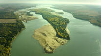
Missouri River National Water Trail
Go here to learn more about the Missouri National Recreational River (MNRR). The reaches of river that border South Dakota and Nebraska are some of the last remaining natural stretches of America's longest river. Come immerse yourself in some of the many experiences and stories to be discovered along this National water trail. Download the interactive map and much more, this site is a great resource!
Go here to learn more about the Missouri National Recreational River (MNRR). The reaches of river that border South Dakota and Nebraska are some of the last remaining natural stretches of America's longest river. Come immerse yourself in some of the many experiences and stories to be discovered along this National water trail. Download the interactive map and much more, this site is a great resource!
Friends of the Missouri National Recreational River (FOMNRR)
See what events and activities are talking place along the MNRR. The mission of the Friends of the Missouri National Recreational River is to build awareness and advocate for the scenic, fish and wildlife, ecological, geological, cultural/historical values and economic and recreational opportunities of the Missouri River, a component of the National Wild and Scenic Rivers System.
See what events and activities are talking place along the MNRR. The mission of the Friends of the Missouri National Recreational River is to build awareness and advocate for the scenic, fish and wildlife, ecological, geological, cultural/historical values and economic and recreational opportunities of the Missouri River, a component of the National Wild and Scenic Rivers System.
Missouri River Basin Daily River Bulletin
Check here to find out the water levels the Corp or Engineers are releasing each day from the dams.
Fort Randall - Generally discharge 'out' levels of 26,000 are average
Gavins Point - Discharge levels 'out' of 20,000 are average
Check here to find out the water levels the Corp or Engineers are releasing each day from the dams.
Fort Randall - Generally discharge 'out' levels of 26,000 are average
Gavins Point - Discharge levels 'out' of 20,000 are average
Northeast South Dakota Glacial Lakes
Explore the many glacial lakes of Northeast South Dakota. Here are maps with location, directions, access points and suggested routes. Most of these lakes lack access for large boats so you can enjoy a quiet and safe paddling environment among scenic native forests or tallgrass prairie.
Explore the many glacial lakes of Northeast South Dakota. Here are maps with location, directions, access points and suggested routes. Most of these lakes lack access for large boats so you can enjoy a quiet and safe paddling environment among scenic native forests or tallgrass prairie.
NPS Goat Island Management Plan
The storied island near Vermillion, SD that was unclaimed land for many years now has a management plan. Noteworthy to paddlers who might camp on the river, pages 26-31 give detail on the proposed improvements. Its a very comprehensive report, it helps you understand the detail of the NPS efforts to accommodate; if possible, the varied interests of us all.
The storied island near Vermillion, SD that was unclaimed land for many years now has a management plan. Noteworthy to paddlers who might camp on the river, pages 26-31 give detail on the proposed improvements. Its a very comprehensive report, it helps you understand the detail of the NPS efforts to accommodate; if possible, the varied interests of us all.
Missouri River Paddlers
From Three Forks, MT. to St. Louis, Mo. and beyond. This is 'THE' resource for planning and paddling North America's longest river from Source-to-Sea and beyond. Past expeditions, Maps, Books & Advice. One of the country's largest paddling facebook groups too!
SDCKA members are active 'river angels', it's often information from Norm Miller, founder of MRP, where you can begin to reach out and catch-up with a paddler to offer assistance or supplies... but mostly it might just be a warm meal and a cold beer and a chance to meet great people.
Boundary Waters Canoe Area
Plan your trip, get map information, find outfitters, subscribe to the newsletter, it's all here on the Boundary Waters website.
Established in 1978, The BWCA extends nearly 150 miles along the international border adjacent to Canada's Quetico Provincial Park and is bordered on the west by Voyageurs National Park. Over 1,100 lakes and 1,500 miles of canoe routes exist in the area of one million acres.
Paddle Planner
'From put-in to take-out' you'll find interactive paddling maps & routes, campsite ratings, portage, lake detail and outfitter information for; BWCA, Voyagers, Apostle Islands, Yellowstone and more.
The most unique feature of the interactive maps is the RouteFinder, which is a paddling route time and distance calculator. Get estimated travel distances and times from just about any point to any other! Where is your next trip?
SDCKA is a Paddle America Club member with American Canoe Association
ACA is a national non-profit serving the broader paddling public. You'll find education, training and events throughout the U.S.A. Great resources about everything paddling!