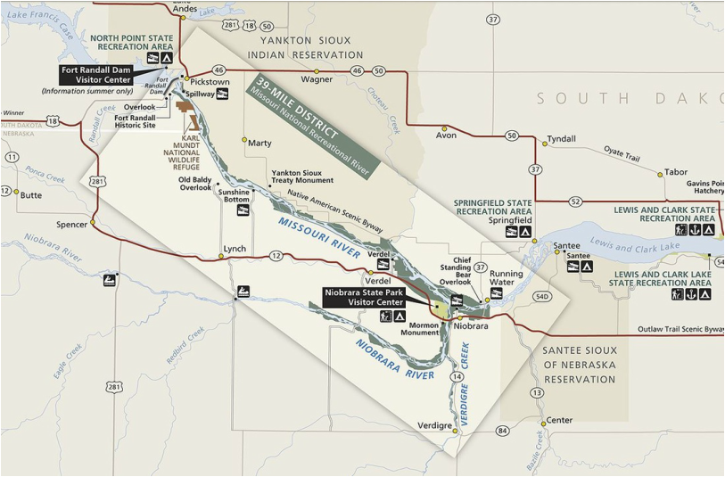
WESTERN 39 mile district
This reach-while influenced by controlled releases from Fort Randall Dam remains in a free flowing condition. It is big open water, 2000-3000 feet wide above it's confluence with the Niobrara River. It meanders through a valley that varies in width from 5,000 - 9,000 feet. On the Nebraska side much of the shoreline is forested chalkstone bluffs adjacent to flat range bottomland. On the South Dakota side the valley bottom is up to one mile wide and is bordered by chalkstone bluffs and rolling hills.
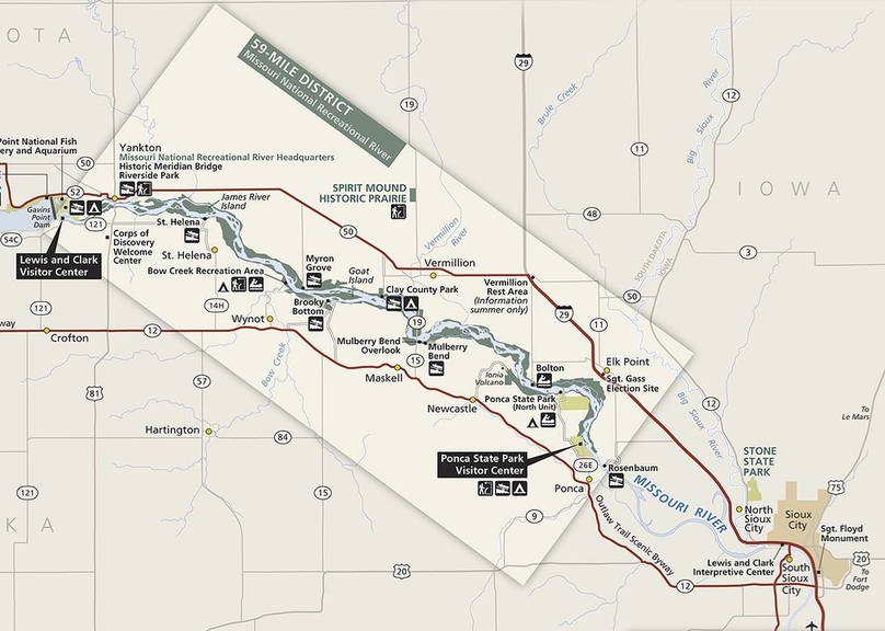
EASTERN 59 mile district
This section - with it's wide, meandering channel, shifting sandbars and secondary channels-contains some of the last forested floodplain and floodplain habitats on the river. Steep, tree covered bluffs and nearly flat level floodplain make up the Nebraska side. On the South Dakota side it is nearly level floodplain. River banks vary from sandy beaches to vertical faces 10 to 15 feet high along with backwater marshes, open sandbars and cotton wood forest. The wind and water make for a real paddling adventure!