Missouri River Water Trail Project: 2026-2027
Here is your chance to make a lasting contribution to the Missouri River that runs through our state, a portion of the 2500 miles that make up North America's longest river.
The National Park Service along with many local groups and organizations is working to make a river trail map of both sides of the vast Missouri River. The map and water trail will run from Fort Randall Dam to Sioux City, IA. Overall the trail distance is nearly 150 miles. with more than 40 locations.
This has never been done, it's special, it's happening and you can be a part of it.
Quality maps, mile marker signage, river miles from point-to-point and more will help paddlers get the most of this wild and scenic water trail. Combine all this with the history, geology and nature that all come together in this unique water trail that includes two of the last natural reaches of the Missouri River.
Here are the plans from our partner at the National Park Service, Harrison Freund, AICP, Outdoor Recreation Planner
Hello South Dakota Canoe and Kayak Association Members,
Thank you so much for your enthusiasm and interest in supporting the Missouri River Water Trail. We are truly excited to have partners eager to support the park through volunteerism. Your contribution is a key component to making this possible. Please understand the weather and everyone's safety will determine the actual time-line of this project.
TRIP DETAILS
The park will be conducting 6 different float trips (described below) along the MNRR 59-Mile District and from Ponca, NE to Sioux City, IA this summer to inventory (ramps, water, toilets, parking, etc.) and document conditions and experiences along the Missouri River. The park is looking for volunteers with lots of local knowledge to join us on these floats to provide your insight. Volunteers will assist the park by allowing it to gather higher quality data through their high degree of familiarity with the Missouri River. Here are the planned trips:
- Riverside Park to St. Helena (6.3 miles)
- St. Helena to Brooky Bottom (10.5 miles)
- Brooky Bottom to Mulberry Bend (9.4 miles)
- Mulberry Bend to North Ponca (13.1 miles)
- North Ponca to Rosebaum (10.7 miles) (The park will attempt to have someone from NPS who will not float take the vehicle at the put in back to HQ to reduce drive time)
- Rosebaum to Chris Larsen Park (15.5 miles)
LOGISTICS
The park wants to make this as simple and easy as possible to participate. The park has pre-selected the tentative dates below for potential outings. These dates are subject to change based on weather and changes in planned park operations. As a volunteer, we would reach out to you in advance of a potential outing. We will select volunteers based on availability, their familiarity with specific segments, and the number of trips you have already gone on. The park will take 1-2 volunteers per outing. NPS Staff are required to be present on each trip. These are our tentative dates:
- 4/27/26 (Monday)
- 5/4/26 (Monday)
- 5/7/26 (Thursday)
- 5/12/26 (Tuesday)
- 5/14/26 (Thursday)
- 5/30/26 (Saturday)
- 6/1/26 (Monday)
- 6/4/26 (Thursday)
- 6/12/26 (Friday)
- 6/15/26 (Monday)
- 6/22/26 (Monday)
- 6/30/26 (Tuesday)
- 7/9/26 (Thursday)
The park can work with you to identify what would be the most logical place to meet up (Park HQ, Put-In, Take-Out) to make your day as convenient and fun as possible. We can provide you transportation from Park HQ to the take-out or put-in and back depending on what makes sense for the group.
TRAINING
All volunteers will be required to complete training to go over safety and the forms we will be using. The park will host two online informational training sessions (you only need to attend one) to review the volunteer opportunity materials on Wednesday, April 22 from 10:30-11:30 and Thursday, April 23 from 5:00-6:00. If you are unable to attend either session, or if you join the project after those dates, please contact Harrison Freund. We will have a safety discussion at each put-in before getting on the water. A link to the training & safety module will be emailed to you after sign-up.
We will be able to provide small tokens of gratitude for your help and insight to help the Missouri River Water Trail live up to its full potential.
If you have you any questions, please contact Harrison Freund ([email protected]) or call 605-665-0209
Thank you for your support in advance, and we look forward to spending time on the river with you.
Kind regards,
Harrison Freund, AICP
Outdoor Recreation Planner
Missouri National Recreational River
508 E 2nd St
Yankton, SD 57078
The National Park Service and the
Missouri National Recreational River
borders South Dakota & Nebraska
Missouri National Recreational River
borders South Dakota & Nebraska
|
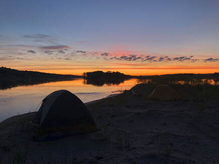
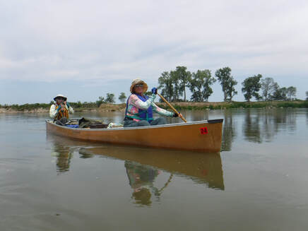
The Missouri River is the longest river in North America. The MNRR has been preserved as the only free-flowing sections.
The Lewis and Clark Expedition traveled along this section of the Missouri from late August to early September 1804, and again on their return trip in 1806. They explored landscape features like Spirit Mound, held council with the Yankton Sioux, and wrote the first reports on pronghorn antelope, mule deer and prairie dogs, all previously unknown to western science at that time. Today the two stretches of the Missouri River along the Nebraska-South Dakota border are vital remnants of the historic river. In 1978 and 1991 Congress preserved these free-flowing sections by designating them as the Missouri National Recreational River and added them to the National Wild and Scenic River System. For more information visit: www.nps.gov/mnrr |